Deadly, fast-rising floodwaters have forced thousands of people to flee their homes in Nebraska, Iowa, Wisconsin and Missouri.
At least three deaths have been blamed on the flooding, the result of a combination of runoff into rivers from the “bomb cyclone” storm that hit the country last week and spring snowmelt.
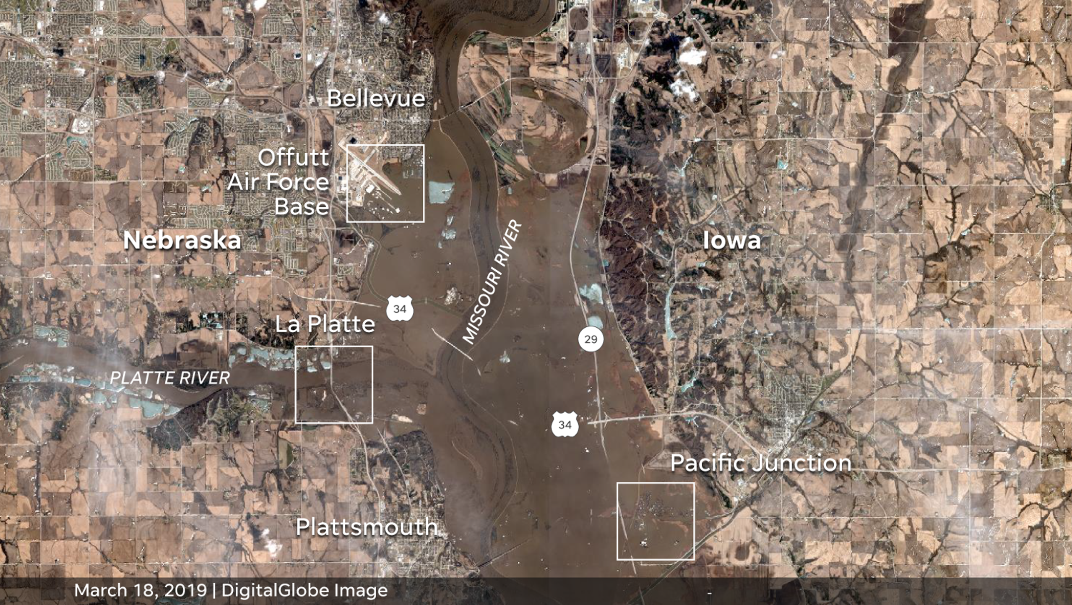
Satellite images provided by DigitalGlobe offer a before-and-after view of the historic flooding of the Missouri and Platte rivers south of Omaha, Nebraska.
The images capture the devastation the flood brought to areas along the river, including parts of Offutt Air Force Base and towns in Nebraska and Iowa.
Below is an image that provides an aerial view of Offutt AFB before and after the floodwaters rose.


The floodwaters have displaced more than 2,000 Iowans, who fled after heavy rains triggered flooding last week.
This image shows the flood’s impact in Pacific Junction, Iowa.


Comments